
Cost-Benefit Analysis
Big Blue River 2nd Connection
Cost-Benefit Analysis
Big Blue River 2nd Connection

Cost-Benefit Analysis
Big Blue River 2nd Connection

Background
The idea of a second roadway crossing (2nd Connection) of the Big Blue River between Manhattan and Blue Township in Pottawatomie County has long been discussed. The purpose of this Cost-Benefit Analysis project is to study and analyze a series of proposed 2nd Connection routes. The study will provide facts and data that will inform and guide future conversations and plans, and help move the region towards a viable solution. Note, this study will not select any of the 2nd connection routes to be built, rather the analysis will provide pros and cons of each route.
This study is funded through a partnership between Pottawatomie County, Riley County, and the City of Manhattan. As a regional, multi-jurisdictional project, the Flint Hills MPO is administering the study. Benesch has been selected as the engineering firm leading the study.
Routes of Study
The map below shows the general alignment of all 2nd Connection routes being studied (A-E).
Route alignments were chosen based on public input, previous studies, and future growth potential.


Final Report

This memo provides the complete findings on the routes of study. Items include:
-
Summaries of each route option
-
Projected vehicle use of each route option
-
Design criteria
-
Plan drawings of proposed routes
-
Profile drawings proposed routes & bridges
-
Itemized cost estimates (planning level)

Organized by Route, these summary boards visualize the data and findings from the Final Report Memo for quick side-by-side comparisons of the five routes studied.
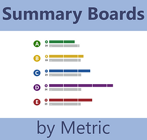
Organized by Metric criteria, these summary boards visualize the data and findings from the Final Report Memo for quick side-by-side comparisons of the five routes studied.

This interactive web map allows you to see in detail the five routes studied. Layers include:
-
Route alignments
-
Bridge locations
-
Flood zones
-
Right-of-Way & property impacts

This interactive tool allows you to compare travel time from Blue Township or St. George to various locations in Manhattan, using 2nd Connection Routes (ie. A vs B vs US-24, etc.). The tool shows predicted travel times for today and under future conditions in 2050.

This tool allows you to compare expected traffic volumes (number of vehicles) on 2nd Connection Routes (A - E), and how those routes impact traffic volumes on US-24. Travel volumes are provided for today and under future conditions in 2050.

These slides are from the Public Information Meetings presentations. They provide information on the background of the study, as well as all information found in the Summary Boards, and next steps.
Fill out the form below to submit your comments or questions regarding the Big Blue River 2nd Connection Cost-Benefit Analysis.
US-24 Corridor Study
A parallel study being conducted by KDOT, the US-24 Corridor Management Plan Update, will update the existing 2009 plan of this critical National Highway System roadway. In addition to the existing segment from Wamego to Manhattan, the plan will extend north and west to the town of Riley. Project data from the 2nd Connection Cost-Benefit Analysis will be used in the KDOT US-24 study, and vice versa.